Since we were unaware of exactly how the train system worked, and both my German and French vocabularies consisted of about 15 words, I was a bit unsure how things would transpire. We approached the ticket counter and I tentatively asked the agent (in German) if she spoke English. She replied (in English), "yes, a little bit." We came to discover that this translates to, "yes, I actually speak English better than you do, you silly Americans." Within 2 minutes we were handed a timetable for our journey to Interlaken. It involved 5 transfers, and about 3.5 hours in total.
We quickly managed to figure out the train system and the essential German words for arrival, departure, platform, etc. We traveled to Interlaken with a short stop in Lucerne, which was a very pretty city on Lake Lucerne.

The Jungfrau
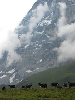
The following day we took a train into Grindelwald, a small winter tourist village which sits below the famous north face of the Eiger. Andrea and I later decided that Grindelwald was our favorite town we had visited, due to its location beneath the mountains and its traditional Swiss feeling.
The following day we took a train into Grindelwald, a small winter tourist village which sits below the famous north face of the Eiger. Andrea and I later decided that Grindelwald was our favorite town we had visited, due to its location beneath the mountains and its traditional Swiss feeling.
 We camped three nights here beneath the north face, and the views surrounding us were absolutely astounding.


 On our first day, we ventured up to the base of one of the big glaciers nearby. Luckily, the Swiss had put in an insane number of steps and a large suspension bridge to aid our hike!


 The next couple days we hiked, climbed, and did a via ferrata (mountaineering with fixed protection and ladders) on Mt. Rotstock, directly west of the Eiger. The approach to Mt. Rotstock required following the famous Eiger Trail.


 While climbing Rotstock, we encountered a pretty complete whiteout. Weary of the oncoming weather, we continued to the summit. Within five minutes of reaching the summit cross, the clouds broke and the sun shone through to reveal the summit of the Eiger. It was one of the coolest things I've ever seen.
However, our awe of this amazing mountain was dulled a bit; during our ascent we had watched a rescue chopper make repeated attempts (finally successful) to rescue a climbing team from the north face. Our descent met up with the usual descent of the Eiger, and we hiked past what was likely the camp of the rescued climbers. We never heard of their fate. At 3970m, the North Face of the Eiger is considered to be one of the most formidable mountaineering challenges; over 64 climbers have lost their lives attempting this famous wall.

 Cairns (piles of rock) marked the climb (above), and a door to an old tunnel through the mountain (below).


 These are the traditional Swiss drinking fountains. This one, however, had a sign that said that it WASN'T drinking water. It was in German. We drank from it. Oops. We lived.
 The following day, we hiked through another whiteout, but this time with rain. It was very eerie to hear the bells of hundreds of cows around us, but not be able to see them. Although we had plans to attempt another summit this day, we were worried about slippery rock, and by the time we reached the base of the climb, we were as close to hypothermia as we wanted to be. Luckily, there was a lift station open, which had electric hand dryers in the bathroom. We stripped and spent a long time drying our clothes and warming up. After a cup of hot cider, the clouds had cleared a bit, and we set off for the hike back down.
 Our next stop was Chamonix, France, which sits at the base of Mount Blanc and has been referred to as the 'death-sport capital of the world.' The air of the downtown was buzzing- everyone with stories from their latest summit, ski, paraglide, etc, and almost every store devoted to meeting the needs of such athletes. At any one time, you could count at least 20 paragliders in the air.
We took a long hike up to the Mer de Glace, a glacier located on the northern slopes of the Mt. Blanc massif. We then climbed a series of about 100m of vertical ladders to reach the bottom of this glacier, which extends 7 km and is 200m deep. One day, under the right circumstances, we would like to return to summit Mt. Blanc. While Mt. Blanc is not considerd too difficult of a summit, it is the the world's deadliest mountain. During peak season, the local rescue service flies an average of 12 missions to rescue climbers, many of whom merely lack respect for the mountain and the sport.


Next we were off to Zermatt, Switzerland to see the Matterhorn, one of the tallest mountains in the Alps. Upon arriving in Zermatt, we had already spent many days and nights in the rain, and we weren't eager to set up the tent in a puddle. So, we opted for a hostel and a hot shower, which felt luxurious. We hiked around Zermatt, attempted another via ferrata, and approached the base of the Matterhorn, where we finally managed to catch a clear glimpse of the peak.
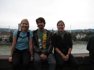
 Finally, we headed back to Basel, where we spent a day with Petz, a friend who used to work in my lab. He made a wonderful tour guide, and we spent the evening drinking beers along the Rhine River.
 We then flew back to London, transferred to a different airport, spent a few hours sleeping in the airport, and were off early the next morning for Dublin!


Incredibly beautiful photos; I can only begin to imagine how lovely it was in person because I visited the Alps while doing study abroad in Vienna. Thanks for the lovely pictures! (I particularly liked the cows... and the idea of the fog obscuring them so you could hear their bells but not see them. You totally walked into at least one cow, didn't you? Be honest, Ash...)
ReplyDeleteSounds like a wonderful trip.
As far as I can tell, you are now only three trips behind and are about to make another to Greece in a day or two!!!
ReplyDeleteWhen you said you were going to hike around Switzerland, I didn't know you meant vertically. I'm sure glad I didn't know about your route beforehand, but beautiful pictures. Daddy
ReplyDelete